

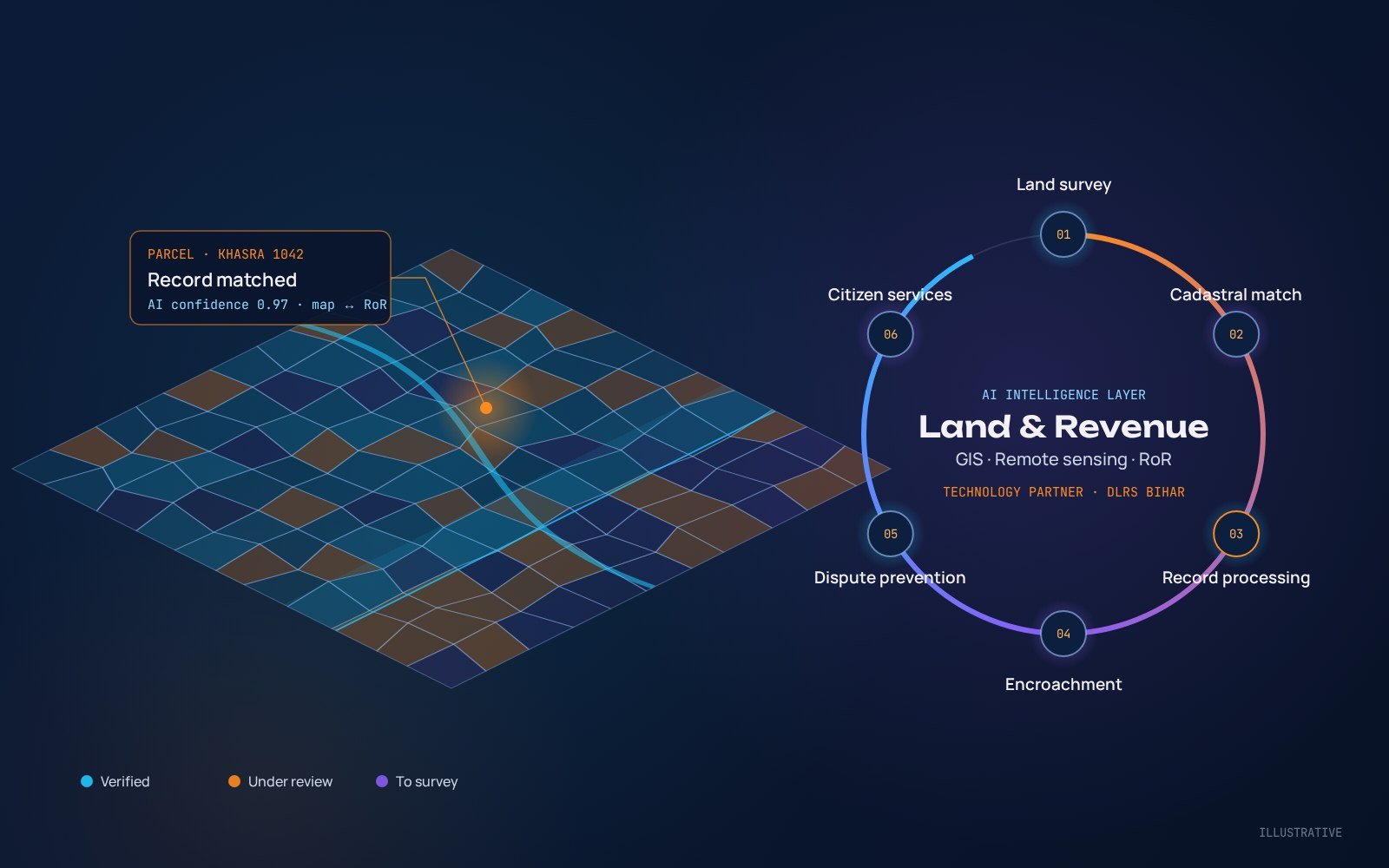
As technology partner of DLRS, Bihar, INNOVOVISION brings AI, GIS and remote sensing together as an intelligence layer over the land and revenue ecosystem.
The opportunity
The future of land governance is moving beyond digitization. The next transformation will come from combining artificial intelligence with GIS, remote sensing, cadastral maps, land records and intelligent workflow automation.
Imagine a land governance ecosystem where AI helps departments identify discrepancies, accelerate surveys, improve record quality, detect potential encroachments and deliver faster citizen services.
INNOVOVISION is the technology partner of the Directorate of Land Records and Surveys (DLRS), Bihar.
Where AI makes an impact
1. AI-powered land survey
AI can analyse satellite imagery, drone data, cadastral maps and survey information to identify parcel boundaries, land-use changes, missing or inconsistent information, boundary anomalies and potential conflicts. This supports faster, more efficient large-scale Special Land Survey programmes.
2. AI and cadastral maps
By comparing cadastral maps, records of rights (RoR), survey data, GIS layers and satellite imagery, AI can flag area mismatches, duplicate or overlapping parcels, map-record inconsistencies, boundary anomalies and missing information.
3. Intelligent land record processing
AI can help extract, validate and match information from land-related documents and applications. Officials receive AI-generated recommendations and exception reports, while keeping the authority for final decisions.
4. AI-based encroachment detection
Combined with satellite and drone imagery and historical land data, AI can help identify unauthorized construction, land-use changes, right-of-way encroachments and encroachment on government land.
5. AI for land dispute prevention
By analysing historical records, survey objections, mutation patterns and complaints, AI can highlight high-risk parcels and inconsistencies before they grow into larger disputes.
6. AI-powered citizen services
A multilingual AI assistant can help citizens understand application status, required documents, survey information, mutation processes, revenue map services and land-record services, making government services simpler, faster and more accessible.
How INNOVOVISION helps
We see AI not as a standalone chatbot or technology layer, but as an intelligence layer over the existing Land & Revenue ecosystem. Our experience across land records, land survey, GIS, cadastral maps, revenue applications and digital government platforms positions us to help departments move from traditional digital systems to AI-enabled land governance.
- AI + Land Survey
- AI + GIS & Remote Sensing
- AI + Land Records
- AI-powered workflow automation
- AI-powered citizen services
- AI-based quality control